
Trace a Bethel Street by Number
A Bethel street directory search works best as a sequence of address checks, not as a single name lookup. Begin with the exact number, street spelling, unit, city, and state. USPS can normalize the mailing line. GIS can identify the parcel. IAS can add an owner snapshot, deed pointer, sales row, and building fields. The Town Clerk can then supply the recorded instrument, while the election guide can place the number in a district range. Historical directories and newspapers add a dated past address.
Keep the difference between owner, mailing party, applicant, registered voter, occupant, and prior household visible in your notes. The public record trail is strongest when the address and source date agree across separate custodians. It is weaker when the only match is a same-name result or a mailing line.
- Run the full address through USPS and save the returned street, unit, city, state, and ZIP.
- Search Bethel GIS by street address, identify the parcel, and record the owner, mailing line, Parcel ID, and layer date.
- Use IAS by Parcel ID, owner, street number, or street name to read the field card and Book/Page pointer.
- Follow the Book/Page and party names through SearchIQS or the Town Clerk counter for deeds, releases, maps, and liens.
- Use the street guide, voter route, permits, and historical directories only for their defined record purpose.
Standardize Bethel Addresses With USPS
Street research fails quickly when the postal line is incomplete. USPS offers By Address, By City and State, and Cities by ZIP Code. The address mode requires Street Address, City, and State. Company, Apt/Suite/Other, and ZIP are optional fields in the captured form. Save the returned street spelling, unit, city, state, and ZIP before opening a local parcel system.
Bethel’s primary postal ZIP is 06801. Secondary reports place some Bethel geography in 06810, the Danbury postal area, but the research did not locate an official USPS or municipal polygon that confirms the exact overlap. That uncertainty is a reason to report the returned ZIP and the legal town separately. A postal city line is not a parcel boundary.
USPS standardizes delivery geography. It does not show who receives mail, who owns a parcel, or who occupies a building. When a street name is shared by nearby towns, add the legal municipality and compare the result with IAS or GIS rather than guessing from a ZIP alone.
The USPS address-lookup capture shows the three search modes and their field patterns.
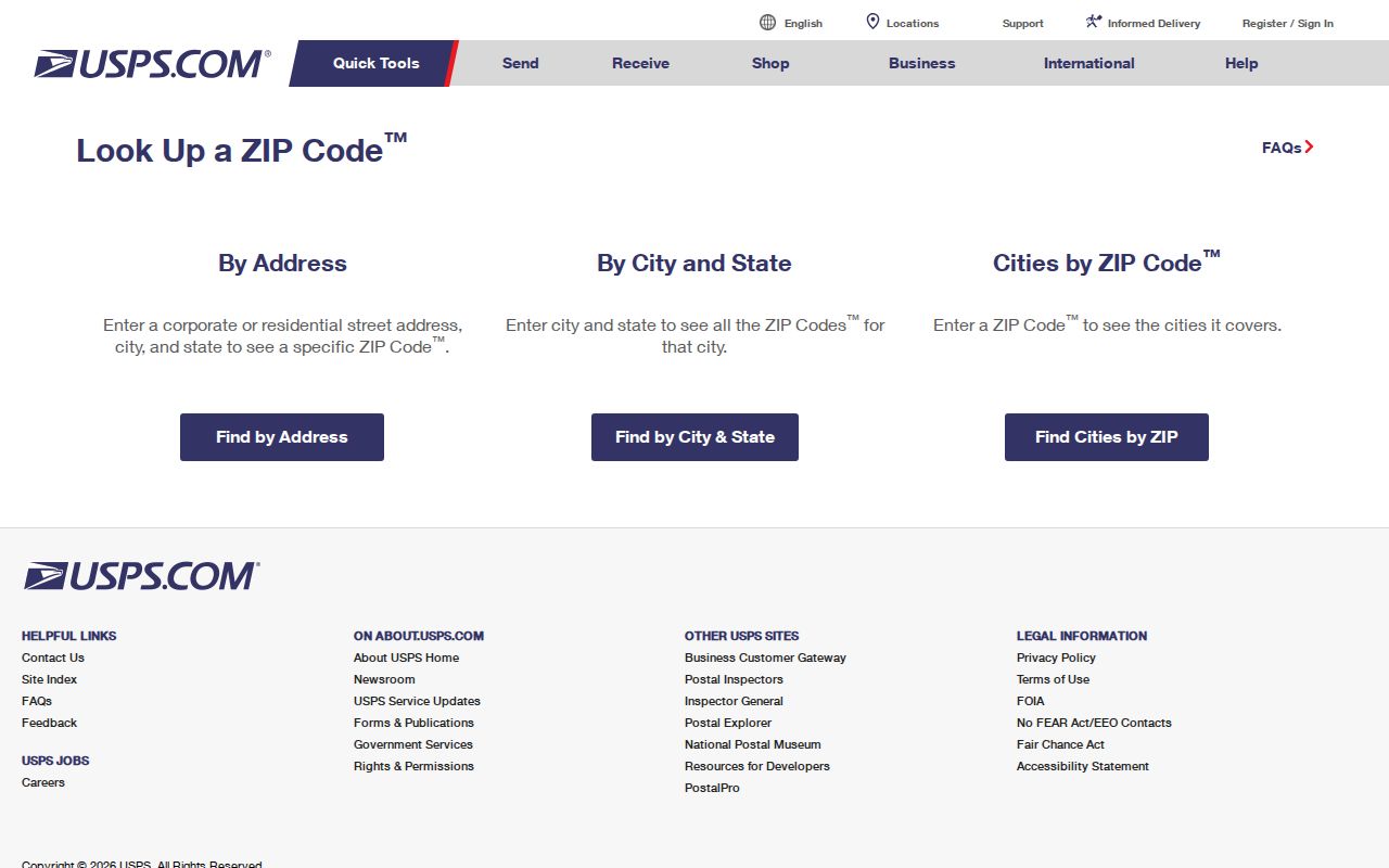
Use the returned postal line as the clean input for the next Bethel street directory step, then preserve its lookup date.
Find Bethel Parcels in GIS
The Tighe & Bond Bethel GIS viewer searches owner, Parcel ID, or street address. The captured configuration uses at least three characters and a contains match, with result columns for Parcel ID, owner, and address. Identify and Parcel Details can add mailing address, city, state, ZIP, lot size, and value. The viewer also supports layers, aerials, measurements, parcel selection, and reports.
Record the layer date with the result. Bethel parcel data is dated November 1, 2024, and ownership data is dated October 1, 2024. Search results are capped at 1,000 with no pagination found. Abutter tools offer 5, 50, 100, 200, 300, 400, and 500-foot distances. The export can contain Parcel ID, owner, mailing address, city, state, ZIP, and street address.
Not every polygon is a dwelling. The REST feature type domain includes Parcel, Condo, Right-of-way, Water, Cemetery, a portion extending beyond town boundaries, and a condominium main parcel. Classify the feature before treating it as part of a street’s residential set. A mailing address is a record field, not an occupancy check.
The Bethel GIS viewer capture shows the search, identify, layer, abutter, and export tools used to connect a street to parcels.
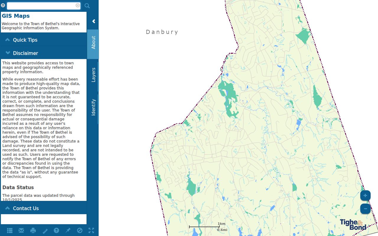
The GIS view is a spatial lead. Verify a recorded land claim through the Town Clerk and date any owner or mailing snapshot before using it in an address trail.
Read a Bethel Assessor Field Card
IAS provides the address-to-parcel detail behind a street search. Search fields include Parcel ID, Alternate ID, Owner 1 Name, Street Number, and Street Name. A returned card can include zoning, land use, acreage, deed volume and page, sale dates and prices, assessment and appraised values, building features, permit indicators, sketch information, and an owner history. The card is an assessment record and can lag a later conveyance.
The public sample at 31 Whippoorwill Road uses Parcel ID 32 47 083 and Alternate ID R01740. It shows 0.46 acres, a Volume 1147/Page 826 pointer, a September 14, 2021 sale line for $408,500, and a prior 2008 sale row. The card also identifies the 2022 revaluation context. Use the pointer to find the recorded instrument, but do not call a card certified title or proof of current occupancy.
| Search field | Type | Required | Bethel use |
|---|---|---|---|
| Parcel ID | Text | Not marked | Exact or partial parcel key |
| Alternate ID | Text | Not marked | Secondary identifier, such as R01740 |
| Owner 1 Name | Text | Not marked | Try surname, entity, trust, and spelling variants |
| Street Number | Text | Not marked | Physical number; check unit information separately |
| Street Name | Text | Not marked | Normalized name and street suffix |
| Search / Reset | Buttons | Not applicable | Submit or clear the field-card query |
The next revaluation has a fair-market date of October 1, 2027. A street directory entry should carry the valuation cycle and access date so that a later card is not mistaken for the 2022 record.
The Bethel assessor search capture shows the five field-card inputs and the Search and Reset controls.
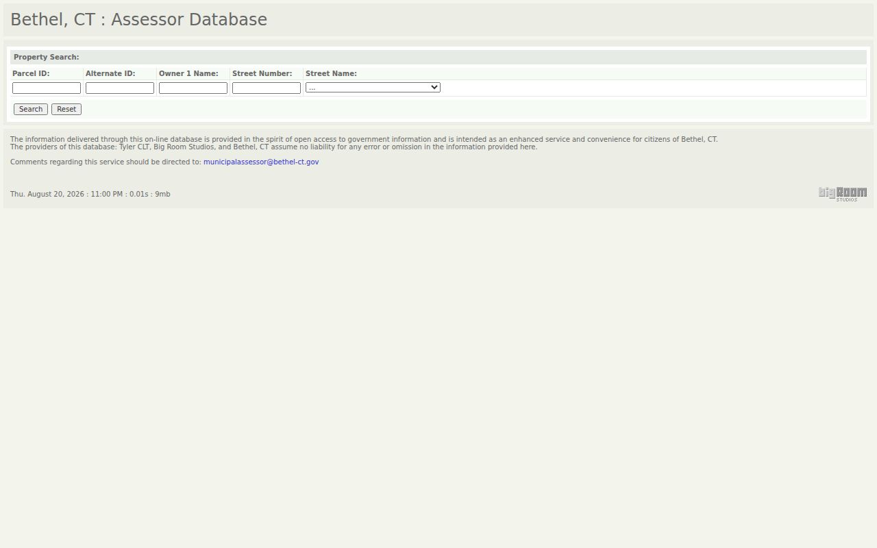
Use the captured fields to create a parcel lead, then move to an independent record source for a stronger conclusion.
Bethel Records Linked by Street
Bethel streets can be traced through several address-keyed record sets, but each one has a defined scope. IAS carries an assessment snapshot. GIS supplies parcel geometry, owner and mailing fields, and abutter tools. The Town Clerk records land instruments. The voter street guide assigns civic geography by side and number range. Building, Planning and Zoning, health, and court records can add a dated transaction tied to an address.
| Record set | Keeper and key | What it shows | Access and limit |
|---|---|---|---|
| IAS field card | Bethel Assessor; parcel, owner, street | Owner snapshot, mailing/situs, deed pointer, sales and building fields | Public search; not certified title or occupancy |
| GIS parcel layer | Tighe & Bond; Parcel ID, owner, street | Geometry, layers, Book/Page, mailing line, abutters | Viewer and REST; data dates and 1,000-result limit |
| Town land record | Town Clerk; grantor, grantee, Book/Page | Deeds, mortgages, releases, maps, easements, and liens | SearchIQS or counter; copy and certification rules apply |
| Street guide | Bethel registrars; side and number range | Senate, Representative, voting district, polling place | Public PDF; not a voter list |
| Building and land use | Bethel departments; address or permit | Permit type, plan, application, notice, comment, and decision leads | Reports and department files; coverage varies |
| Court property search | Judicial Branch; town, street, ZIP | Case parties and status in the defined court categories | Limited record types and dates; not title or occupancy proof |
The address is the bridge, but it is not the conclusion. Use the parcel number to connect IAS, GIS, and a deed pointer. Use the street number and side to read the election guide. Use a permit number or case number to retrieve the underlying record. A street directory becomes more reliable when it states what the source can show and what it cannot.
Carry Bethel Book and Page to the Clerk
The parcel card is only the first half of a title trail. Bethel has no Fairfield County recorder for local land records. The Town Clerk holds deeds, mortgages, releases, easements, liens, maps, surveys, trade names, and related municipal records, with local custody stated from 1855 through today. Start with the IAS Book/Page value, then search the grantor and grantee names, street or legal description, instrument type, and recording date.
The Bethel Town Clerk office page gives the counter route and contact information for Lisa Bergh. The office is at the Clifford J. Hurgin Municipal Center, 1 School Street, and can be reached at 203-794-8505 or 203-794-8506. Hours are Monday through Wednesday 8:00-4:30, Thursday 8:00-6:00, and Friday 8:00-noon. SearchIQS is the online land-record route, but an authenticated result grid and image were not exposed in the research session.
In-office land-record copies are listed at $1 per page. The current standard recording schedule is $70 for the first page and $5 for each additional page, effective July 1, 2025. A portal image is not an official copy. When a street history matters, request the recorded instrument or a certified copy rather than relying on a screenshot.
Search later releases, assignments, easements, and liens as well as the deed itself. A Book/Page pointer is a crosswalk, not the conclusion.
Read Bethel Voting Districts by Range
The Bethel street guide is a useful civic geography layer because it breaks a street into side and number ranges. Its columns are Street Name, Side, Range, Senate, Representative, Voting District, and Polling Place. Street name alone is not enough. Chestnut Street splits odd and even ranges between Districts 1 and 3. Rockwell Road crosses Districts 1, 2, 3, and 4. Walnut Hill Road reaches Districts 1, 2, and 4.
Use the guide to catch a transposed number, wrong side, missing unit, or nearby-town spelling. The guide does not reveal whether a named person is registered, whether a person voted, or who else shares an address. Those questions use a separate official voter route with its own public fields and privacy limits.
The Bethel street guide PDF lets a number be checked against district and polling-place ranges. Record the page and lookup date when the result is part of an address file.
The state voter screen is a different kind of source. The official voter-lookup capture preserves the state route, although the live endpoint rejected automated inspection during research.
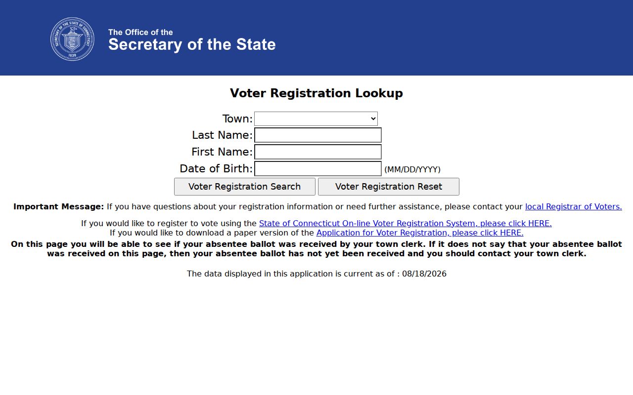
Use the capture as a source pointer, not as a voter result. A protected or undisclosed record can be absent by design.
Search Bethel Permits by Address
Address-keyed permits add a dated activity layer to a street directory. Bethel’s Building Documents page points to CitySquared and lists building plan review, residential and commercial applications, inspections, demolition material, pool worksheets, and related checklists. Public form and search controls inside the portal were not exposed, so an address result should be treated as a lead until the Building Department confirms the record.
The Bethel Building Documents route also points to a 2025 permit-type report and 2026 monthly permit reports. Use the permit number, issue date, type, address, and status. A permit can show that a municipal transaction involved a property, but it does not prove a person stayed there or that a later transfer occurred.
Planning and Zoning files can add an application, plan, neighboring-owner notice, comment, or decision. The Bethel Planning and Zoning page shows the department route, while address pages for 48/50 Nashville Road and 72 Reservoir Street illustrate how supporting documents are posted. Health applications and alarm forms also use property or owner fields, but access and retention rules were not located.
Keep permits separate from title records. A plan, inspection, or demolition file is an address event, not a complete owner or household history.
Translate Older Bethel Street Numbers
Modern address search can miss a historical household when a record uses Danbury, an old street name, a different number, or a regional directory title. Bethel’s 1855 separation from Danbury is the first jurisdiction check. The 1777 Danbury record fire is another reason to expect indirect evidence. Keep the original printed address before translating it to a current parcel.
Bethel’s library, historical collections, newspapers, maps, and directories provide the bridge. A 1918 Danbury and Bethel Directory entry can be paired with a nearby census year, a newspaper notice, the 1889 Sanborn map, a deed legal description, and a present IAS or GIS parcel. A criss-cross or numerical directory may let an address lead to a name, but it still represents a publication date rather than a current household.
The Bethel Public Library Connecticut resources page points to CTDA, local photographs, P.T. Barnum material, the 1986 architectural survey, and licensed genealogy resources. Adult Services can help confirm shelf holdings when the exact printed run is not cataloged online. The historical collection itself is treated in more depth on the Bethel city directory page.
Note: An old number should be translated through maps, deeds, and parcel clues, not modern spelling alone.
Use Bethel Court Property Searches Carefully
Connecticut’s Judicial Branch offers a property-address search for defined case categories. The captured controls include Case Type, City or Town, Street Address, ZIP, Property Type, Case Status, and Search. City or Town requires at least three characters and accepts a partial value. Street Address is optional and partial. A ZIP must be the full five digits.
The Judicial Branch property-address search covers limited property case material, with foreclosure cases on or after January 1, 2014 and separate case-category coverage rules. A result can show a case party, docket, status, or property address. It is not a title certificate, a general street roster, or proof that a named party occupies the address.
For a name or docket, use the party and docket routes instead of stretching the address search beyond its scope. Check the court location, case category, dates, and public-access disclaimer. Older, sealed, juvenile, restricted, or omitted material may require a clerk inquiry.
A court address record is best used as one dated strand in an address chain. It should not override a recorded deed or be used to publish a person list.
Date Every Bethel Address Trail
A clean Bethel street directory record should show the evidence path in order: USPS address output, GIS parcel and data date, IAS card and revaluation cycle, Town Clerk Book/Page or an explicit index gap, civic range, and a dated historical source where needed. The chain can be written as one process: address to parcel, parcel to owner snapshot, owner snapshot to recorded instrument, instrument to prior party, then prior address to directory or newspaper.
Keep the physical situs address apart from the mailing address. A situs address identifies where the parcel is located. A mailing line can point to the property, a trustee, an entity, or a different place. A plat is a map or recorded plan that helps describe lots, roads, and boundaries. A criss-cross directory is an address-centered historical finding aid. These terms keep an address search from making a larger claim than the source supports.
- Parcel
- A mapped property unit used by IAS and GIS to connect an address, owner field, and land reference.
- Situs address
- The physical location assigned to the parcel, distinct from a tax or correspondence mailing line.
- Plat
- A recorded map or plan that can show lots, roads, easements, and subdivision context.
- Criss-cross directory
- A reverse or numerical directory that starts with an address or listing rather than only a surname.
For the sample 31 Whippoorwill Road card, preserve Parcel ID 32 47 083, Alternate ID R01740, the 1147/826 pointer, the sale date, and the access date. Verify the pointer with the Town Clerk before calling it a title fact.
The Bethel Whippoorwill parcel-card capture shows the kind of fields that can anchor a street trail.
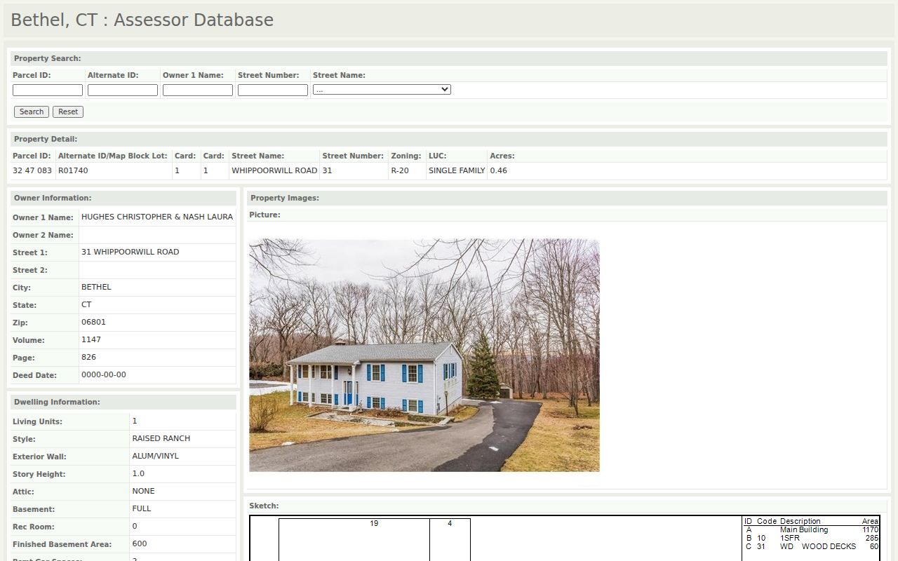
The sample is an assessment snapshot with a useful deed pointer. It is not a certified deed and does not establish who currently lives at the address.
Limits of a Bethel Street Directory
A street directory will not reveal every occupant, guest, delivery recipient, utility customer, or protected resident. The owner line and mailing field are not an occupancy roster. DMV name and address data is controlled by the Driver’s Privacy Protection Act, utility customer lists are not an ordinary municipal lookup, and ACP or voter privacy protections can intentionally suppress an address.
USPS can standardize a postal address without linking it to a person. GIS can show a neighboring parcel without proving its use. A court address result can show a party without proving title or presence. A historical directory can show a printed address without proving a later move. State the evidence level and the source date for every conclusion.
Lawful personal use. Bethel address records can support careful family, property, genealogy, and civic research. Do not use a name, phone result, mailing line, or parcel lead to stalk, harass, threaten, monitor, or harm another person.
Note: A complete address trail is still a documented set of sources, not a promise that every resident will appear.